
![]() Deutschsprachige
Texte sind durch die deutsche Flagge markiert.
Deutschsprachige
Texte sind durch die deutsche Flagge markiert.

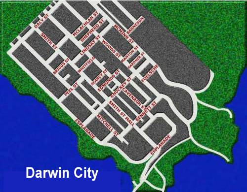
 Northern Territory
AREA: 1,346,200 sq. km., POPULATION: 160,000
CAPITAL: Darwin (100,000)
LOCATION: In the
Central-north of Australia between Queensland and Western
Australia, and north of South Australia. CLIMATE:
Highest temp. 48.2° C at Charlotte Waters; lowest -7.5°
at Alice Springs. The Top End has a high rainfall in the
'Wet Season' (Nov.to March) with warm winters due to its
proximity to the equator. The southern section has mainly
hot, dry weather with very cold winter nights.
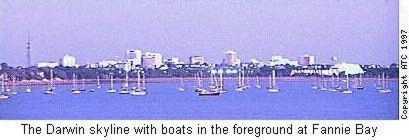
Darwin was first settled in 1839 after 2 previous
attempts.
On Christmas Eve, 1974 it was practically obliterated by
Cyclone Tracy and was rebuilt over the ensuing years with
cyclone proof houses and is now Australia's most modern
city.
It is also one of the fastest growing. Prior to the
cyclone there was a population of around 44,000, there
are now over 100,000 people living in and enjoying
Darwin.
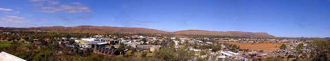
In the south, Alice Springs began as a repeater station
on the Overland Telegraph Line between Adelaide and
Darwin and grew slowly as people congregated around the
tiny settlement. It was not until the railway line
reached there in 1929 that the town began to prosper.
Alice Springs had a population of some 8,000 in 1969.
Today there is in excess of 30,000 living there.
The main industry of the Territory is beef cattle and
massive stations measured in thousands of square
kilometres comprise around half of the state. The other
half is occupied by aboriginal groups and a permit is
needed to access much of this land.
Uranium is mined in the mid-north and Tennant Creek has
copper mines.
It was announced in November 1999 that continuation of
the railway line from Alice Springs to Darwin would
commence shortly. This guarantee was contained in the
hand-over documents when administration of the Northern
Territory passed from South Australia to the Federal
Government in 1911 but has been ignored by successive
governments (excluding the Fraser Government of the
1970/80's which charted a route for it) until now.
Completion will open up fast passenger and freight
services between Asia and the Southern and Eastern
populated areas and should see increased growth and
development of the Territory.
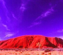
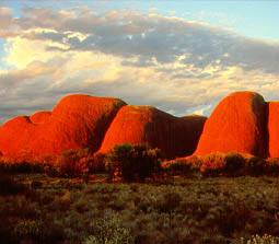
The Northern Territory contains two of Australia's best
known attractions. Kakadu in the north, and Ayers Rock
(Uluru) in the south.
| Darwin | Jan | Feb | Mar | Apr | May | Jun | July | Aug | Sept | Oct | Nov | Dez |
| Temperature max. (C) | 32 | 32 | 32 | 33 | 32 | 31 | 30 | 31 | 33 | 34 | 34 | 33 |
| Temperature min. (C) | 25 | 25 | 25 | 24 | 22 | 20 | 20 | 21 | 23 | 25 | 25 | 25 |
| Rainfall (in mm) | 391 | 330 | 260 | 103 | 14 | 3 | 1 | 2 | 13 | 50 | 126 | 243 |
| Water Temperature (C) | 29 | 29 | 29 | 28 | 28 | 26 | 26 | 24 | 27 | 27 | 29 | 29 |
| Alice Springs | Jan | Feb | Mar | Apr | May | Jun | July | Aug | Sept | Oct | Nov | Dez |
| Temperature max. (C) | 37 | 36 | 33 | 29 | 23 | 20 | 19 | 22 | 26 | 31 | 34 | 35 |
| Temperature min. (C) | 22 | 21 | 18 | 14 | 9 | 6 | 4 | 7 | 10 | 15 | 18 | 20 |
| Rainfall (in mm) | 34 | 39 | 22 | 12 | 17 | 16 | 13 | 12 | 6 | 20 | 23 | 32 |
 In Vorbereitung